Date/Time
Date(s) - 04/14/18
8:00 am - 5:30 pm
Category(ies)
List of Attendees
- Rony K
- Peter de Lastic
- Deborah Saulino
- Loann Nguyen
TALLULAH GORGE STATE PARK
Date: Saturday, April 15, 2018
Hiking Distance: 6 – 7 miles
Difficulty Level: D3 (Moderate)
Carpool Time: 8:00 AM at Intown Community Church
Cost: $15 per person
Hike Leader: Rony
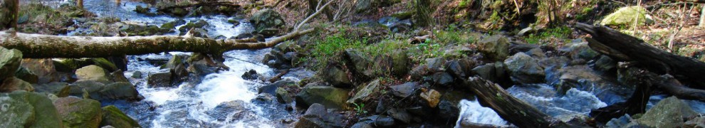
Tallulah Gorge State Park has some great looking waterfalls and easily walked trails. The difficulty level of D3 is only given because part of the hike includes the climb down and back up stairs.
On this Saturday, the water release from the dam is for whitewater boating, the flow is 500 CFS. Water thunders through the gorge as kayakers challenge their skills & spectators watch from the rim. The Peregrine Falcons have been spotted again at Tallulah Gorge State Park. If we are lucky, we may be able to spot them from the South Rim trail.
North & South Rim Trails
3 miles, round-trip. The North and South Rim Trails consist of 3 miles round-trip. It is a mulched trail with exposed roots that is a leisurely walk. From the Interpretive Center there is a recycled rubber tire trail that accesses Overlooks 2 and 3.
North Rim Trail
Access this trail behind Interpretive Center. It is approximately 3/4-mile one-way, moderate with some inclines and stairs. This trail has five Scenic Overlooks described below:
1. Best southern view into the gorge. Oceana Falls is below, with Bridal Veil Falls at the far end of the gorge. Tightrope walker Karl Wallenda walked from this overlook to his tower on the south rim in 1970. Another aerialist, Professor Leon, made a similar walk from the north to the south rim in 1886. Gorge depth is 750 feet.
2. View of L’Eau d’Or (pronounced Ladore) Falls, top of Tempesta Falls, and Hawthorne Cascade and Pool. Gorge depth is 350 feet.
3. View of L’Eau d’Or Falls, Hawthorne Pool, and remains of a water compressor plant used in building Tallulah Falls Dam.
4. Good view of Tallulah Falls Dam (completed in 1913) and upper portions of the gorge.
5. View of upper gorge and southern view to Hawthorne Pool and Overlooks 2 and 3. Gorge depth is 250 feet.
South Rim Trail
Located on the opposite side of the gorge from the Interpretive Center and is approximately 3/4-mile one-way, moderate with inclines. This trail has five Scenic Overlooks described below:
6. View of Hawthorne Pool, North Rim Trail Overlooks 2 and 3, top of Tempesta Falls and down gorge towards Hurricane Falls. Gorge depth is 350 feet.
7. View of Hawthorne Pool, Tempesta Falls and Pool. Gorge depth is 400 feet.
8. View of Hurricane Falls and Pool, “Devil’s Pulpit” outcrop below, and the Interpretive Center is across the gorge. Gorge depth is 500 feet.
9. View of Hurricane Falls, Oceana Falls, Caledonia Cascade (600 feet), and North Rim Overlook 1. Gorge depth is 650 feet.
10. View of Caledonia Cascade and the Wallenda north tower area. Bluff to far right is approximately 1,000 feet high.
SHORTLINE TRAIL (multi-use)
3 miles. Paved. Rated easy.
This trail can be accessed from Terrora Circle Road, is paved and can be used for hiking, biking, skating, etc. It follows part of an old railroad bed. This trail is very flat and follows the river upstream.
Things to bring:
– Backpack / Daypack
– Lunch /snacks
– Water (1.5 – 2 liters)
– Hiking Shoes/ good tennis shoes
– Camera / Binoculars (optional)
Bookings
You must be a member to sign up for an event. Click on Members and Signup.